Despite the hysterical press that drones have been getting recently caused by irresponsible amateur pilots, they do have many positive professional uses, especially for aerial surveying or real estate applications.
Below are two panorama images taken from between 70m and 120m above our school using a DJI Inspire 1. The drone takes 20 images in a 360 degree pattern, then special software is used to "stitch" them together. The results are astounding!
Click on the images to view these interactive panoramas. Once the images have loaded you can click and drag your mouse to move around the image.
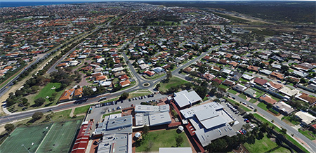
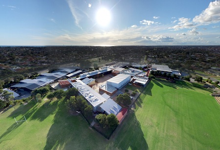
Pretty amazing stuff!